There are plenty of moderately challenging Vancouver hiking trails to choose from. These are five trails that stand out from the rest. Not too difficult, yet all have sensational views. Hollyburn, Dog Mountain and Mt Seymour are at the end of beautiful drives to reach the trailheads.
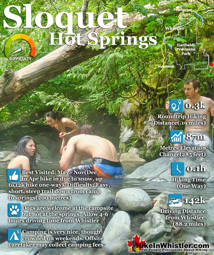
Sloquet Hot Springs is a wonderfully wild set of shallow, man-made pools fed by a small, all natural, and very hot, waterfall. The pools stretch from the waterfall to the large and crashing Sloquet River. The large, spread out campsite for the hot springs lies a short 5 minute walk from the springs. You have to follow a dark and quickly descending trail toward the crashing river.
Incredible setting for relaxing in deep wilderness
Fed by a waterfall & located next to a rushing river
Drive in campsites are nicely spaced in the forest
Springs & campsite are separated by a short trail
Skookumchuck is on the way to Sloquet
Several pools & two are quite large
Far from civilization so often quiet
Well laid out drive-to campsites
Hike there in winter & you will have it to yourself!
As you near, you can smell the unusual, but kind of nice hot springs scent, and you see steam rising all around you, some steam rising, bizarrely, out of the grass clearing on the edge of the river. On your left a rising cliff, on your right the crashing river. The path narrows and steepens, leading to a large fallen tree which the trail seems to run to. So huge though as to not worry you walking the length of. Then, there it is. The massive fallen tree flanks it. Nestled between the tree and a cliff, in a large triangular area, with the river forming the third side are the Sloquet Hot Springs. Sloquet Hot Springs is 142 kilometres from Whistler, which translates to well over 3 hours of driving. Much of the driving is along the In-Shuck-Ch Forest Service Road, which runs the length of the very scenic Lillooet Lake and river. This gravel road takes you well into the wilderness, far from civilization and past quite a few nice sights along the way. Just 20 minutes north of Whistler you pass Nairn Falls Provincial Park. This is a great pit-stop on the journey to Sloquet, whether you hike the short, 1.2 kilometre trail to the falls or just check out the river viewpoint near the parking lot. Back on the highway, Pemberton is just 5 minutes north of Nairn Falls. This little town is your last chance for gas, food, alcohol, ect before Sloquet. Continuing through Pemberton, on the way to Sloquet you will pass North Arm Farm. This is a great place to visit. You can wander around the beautiful farm grounds, visit the interesting farm animals and marvel at the amazing view of Mount Currie. The farm is free to visit and open weekends in the winter and everyday the rest of the year. They have a fantastic cafe with all sorts of baked goods and lunch items as well as various farm fresh produce for sale as well. Also, a great place for your last coffee before entering the wilderness.
Another 10 minutes on the highway further and you come to the turnoff to the In-Shuck-Ch Forest Service Road and begin the long and beautiful drive along Lillooet Lake. There are several excellent places to stop along the way. From the obvious and frequent viewpoints along the road to the numerous campsites along the way. Even if you have no intention of camping, these are great places to stop and see Lillooet Lake, have a beer, swim, or all three. Depending on the season, Lillooet Lake can be emerald, though cloudy green or muddy brown. This is all dependent on the spring runoff and especially the silty brown, Lillooet River that flows into Lillooet Lake from Pemberton.
Explore Whistler Hiking Trails!
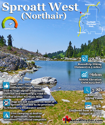
Mount Sproatt, or as it is known locally as just Sproatt, is one of the many towering mountains visible from Whistler Village. Above and beyond Alta Lake, directly across from Whistler Mountain and Blackcomb ...
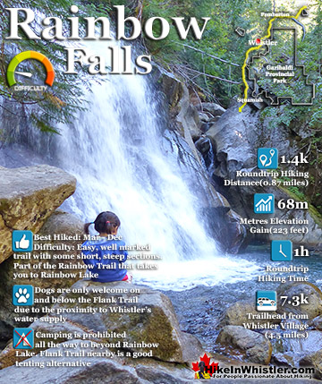
The short, scenic and easy hiking trail to Rainbow Falls is found at the same, much more well known trailhead for Rainbow Lake. The trailhead is marked as the Rainbow Trail and the trail quickly ascends ...
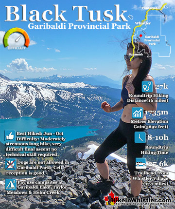
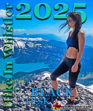
Black Tusk is the extraordinarily iconic and appropriately named mountain that can be seen from almost everywhere in Whistler. The massive black spire of crumbling rock juts out of the earth in an incredibly ...
Whistler is an amazing place to hike. Looking at a map of Whistler you see an extraordinary spider web of hiking trails. Easy trails, moderate trails and challenging hiking trails are all available. Another marvellous thing about Whistler is that Garibaldi Provincial ...
Squamish sits in the midst of some amazing places to hike. Garibaldi Park sprawls from Squamish up and beyond Whistler. Tantalus Provincial Park lays across the valley to the west and the beautiful and desolate, by comparison, Callaghan Valley to the north. Add to ...
Clayoquot Sound has a staggering array of hiking trails within it. Between Tofino and Ucluelet, Pacific Rim Park has several wilderness and beach trails, each one radically different from the last. The islands in the area are often Provincial parks on their own with ...
Victoria has a seemingly endless number of amazing hiking trails. Most take you to wild and beautiful Pacific Ocean views and others take you to tranquil lakes in beautiful BC Coastal Rainforest wilderness. Regional Parks and Provincial Parks are everywhere you turn ...
The West Coast Trail was created after decades of brutal and costly shipwrecks occurred along the West Coast of Vancouver Island. One shipwreck in particular was so horrific, tragic and unbelievable that it forced the creation of a trail along the coast, which ...